Neighborhoods in north Evans and Appling sit closest to Clarks Hill (Thurmond) Lake, with public ramps and parks nearby. True waterfront lots are limited, because the Army Corps of Engineers controls the shoreline. Ask about dock permits and Corps rules before you buy.
That’s the short answer. Here’s what it means when you’re picking a home.
Maybe you’ve pictured it already. A Saturday morning. Coffee in one hand, the boat hitched to the truck, and the water ten minutes away. Or a backyard that runs down to your own dock.
Then you start looking at listings, and the words get slippery. “Lake view.” “Lake access.” “Waterfront.” “Dock possible.” Those mean very different things on Clarks Hill. And the difference can cost you the exact thing you moved here for.
You’re the hero of this story. You don’t need to learn federal shoreline rules on your own. You need a guide who knows which questions to ask before you fall in love with a house. That’s our job. The Fairey Team helps buyers across Evans, Martinez, Grovetown, Harlem and Appling from our office in Evans. Our Team Lead, Ehrin Fairey, served on active duty in the Air Force and still serves in the Air Force Reserve, so we also know what military families want from a weekend at the lake.
This question is #17 on our Columbia County FAQ page. We’re adding a short video answer there soon, next to the rest of our quick answers.
First, One Lake With Two Names
Clarks Hill Lake and J. Strom Thurmond Lake are the same lake. Most locals say Clarks Hill. The U.S. Army Corps of Engineers, which built and runs it, calls it J. Strom Thurmond Dam and Lake.
It’s big. The Corps says it’s the largest Corps project east of the Mississippi River. At full summer pool, the lake covers nearly 71,100 acres with about 1,200 miles of shoreline. It sits on the Georgia–South Carolina line, and Columbia County sits at its southern end, near the dam.
Where Columbia County Meets the Lake
Think of the county like a map with the lake along the top. The farther north you live, the closer the water.
- North Evans. The closest lake access for most Evans buyers. From Evans Towne Center Park, it’s roughly 13 to 15 miles, about 25 minutes without traffic, to Wildwood Park, Lake Springs or West Dam. You keep Evans shopping, schools and services, and you can still get to a ramp after work.
- Appling. Lake country. Wildwood Park, Mistletoe State Park, Petersburg Campground and Pointes West all have Appling addresses, and Appling has many of the county’s bigger lots. From central Appling, Wildwood Park is about 9 miles away and Mistletoe State Park about 13. Our Appling guide covers the commute, schools, wells and septic.
- Harlem. Small-town living, land and quiet, with the lake a drive north through Appling. See our Harlem guide.
- Martinez and Grovetown. Farther south. You’ll drive to the lake, but you’re closer to everyday errands and, from Grovetown, Fort Gordon. Our Evans vs. Grovetown comparison helps you weigh it.
Here’s the thing most people miss. You don’t need a waterfront lot to enjoy this lake. For most families, a short drive to a good ramp matters more than a dock out back.
Public Lake Access in Columbia County
These are the main public places on the Columbia County side to swim, fish, camp or launch a boat. Hours and closures change, especially as Hurricane Helene repairs continue, so check each page before you go.
- Wildwood Park (Columbia County). The county’s big lake park at 3780 Dogwood Lane in Appling. Columbia County lists a six-lane mega boat ramp, 61 campsites with water and electric, a beach area and seven covered pavilions. Day entry is $3 per car or $6 with a boat, and an annual pass is $30.
- Mistletoe State Park (Georgia State Parks). At 3725 Mistletoe Road in Appling. Georgia State Parks lists 1,920 acres, three boat ramps, 10 cottages, 93 tent, trailer and RV campsites and a seasonal sand beach. It’s known for bass fishing. A parking fee is required. The park lists a closure on November 17 and 18 for a managed deer quota hunt.
- Lake Springs (Corps). Its Deer Run picnic area, boat ramp and fishing pier are listed as open year-round. Other sections are closed for now. The Corps charges a $7 per-vehicle area use fee here. Paving work is scheduled there on November 18, 2026, so expect a temporary closure.
- West Dam (Corps). A day-use area near the dam, scheduled to open again April 1, 2027.
- Petersburg Campground (Corps). In Appling. Sites 1 to 27 are open, and the full campground is set to reopen April 1, 2027. Paving is scheduled for December.
- Corps boat ramps. The Corps lists smaller Georgia launch areas too, including Keg Creek, with a courtesy dock and ramp light. Around the whole lake, it manages nine day-use areas and 29 access areas, plus state parks, marinas and county parks run by others. The Corps day-use page has the current list.
The Corps announced Helene recovery paving at its Thurmond parks from October 26, 2026 through March 2027, with rolling closures. For the full recovery story, read our Clarks Hill Helene recovery update.
Why True Waterfront Is Rare
On a lot of lakes, you buy a house and own down to the water. Not here.
The federal government owns the land around the lake, roughly 80,000 acres of it. Your private lot stops at the government property line. The Corps says all land below that line is public land. The line is based on elevation, set near 346 feet above sea level and marked by pins and monuments. That’s why the strip between a backyard and the water can be a few feet on one lot and much wider on the next.
The Corps also zones the shoreline. Its allocation maps break it down like this:
- Limited Development (green), about 18% or 211 miles. The only zone where private docks for neighboring owners may be considered.
- Protected Shoreline (yellow), about 62% or 715 miles. No new private structures.
- Public Recreation (red), about 15% or 178 miles. Parks and ramps. No private facilities.
- Special Use (orange) and Prohibited Access (blue). Leased areas and areas near the dam and operations.
Private lake neighborhoods are scarcer here than you might think, too. The Corps’ master plan counted 27 subdivisions and private club sites along the lake in Columbia County, compared with 63 in Lincoln County.
So when a listing says “lake lot,” ask which color it touches. Fewer than one in five shoreline miles can even be considered for a private dock.
Dock Rules Every Buyer Should Know
Here’s what the Corps’ Shoreline Management program says, in plain words:
- A dock needs a Shoreline Use Permit. Anything you build or do on public land, from a dock to clearing brush, needs Corps approval first.
- The permit doesn’t come with the house. Permits run five years. When the home sells, the seller’s permit becomes null and void. You apply for your own.
- An existing dock isn’t a promise. Most permitted docks can be permitted to a new owner. But some are “grandfathered” to the current owner and must be removed when the property sells.
- Only a field inspection tells you for sure. Dockability depends on zoning, location and spacing from other docks. The Corps encourages buyers to request a field inspection before they buy.
- Newer rules matter. Under the plan that took effect May 1, 2018, a lot needs at least 20 feet of shared boundary with federal land to qualify for a new dock. Subdivisions platted after that date get community docks only. New electrical systems on public land and docks must be solar powered.
- Stay on your side of the line. No mowing, clearing or building on public land without a permit. Encroachments, even overhangs, must be removed. The Corps urges owners to get a licensed survey.
You can reach the Thurmond Project Office at 800-533-3478. If a dock matters to you, we’ll make that call early, before your due diligence clock runs out.
Plan for the Water to Move
The lake isn’t a swimming pool with a fixed level. The Corps’ 2022 master plan says it usually reaches full summer pool, 330 feet above sea level, in April and stays within a few feet of that until September. From September to mid-December, it’s lowered to about 326 feet to make room for winter and spring rain. Levels also swing with rainfall and drought, so the Corps notes they can fluctuate a lot.
A cove that looks perfect in June can be mud in November. So look at a dock lot in the fall if you can. Ask how deep the water is at the end of the dock, and whether the permit lets you move the dock out to “chase water.” Some permits don’t.
What’s at Stake If You Guess
A family buys a home for the dock, then learns the permit didn’t transfer and the lot isn’t dockable anymore. Another clears brush on public land without a permit and ends up dealing with the Corps. Someone else buys in a new subdivision and finds out only a community dock is allowed.
None of that has to happen to you. Every one of those problems can be checked before you’re locked in.
The Rest of Your Lake-Home Checklist
- Flood zone. Most of Columbia County isn’t in a high-risk flood zone, but homes near creeks, low spots and parts of the lake can be. Check the FEMA flood map for the address, and get a quote before due diligence ends.
- Well and septic. Rural homes in Harlem and Appling often use them. Plan those inspections.
- Insurance. Get a real quote for the exact home, not a guess.
- Survey. It shows where your lot ends and public land begins.
- Schools and commute. Check the school by exact address. Then drive the commute on a weekday morning. Our Fort Gordon commute guide helps.
All of this fits inside your due diligence window. Our guide to how Georgia’s due diligence period works explains the timing.
Your Simple 4-Step Plan
- Decide what “lake life” means to you. A short drive to a ramp? A view? Your own dock? Each one points to a different part of the county and a different price.
- Pick your area. North Evans for convenience. Appling for lake country and land. We’ll help you compare.
- Check the shoreline before you offer. Zoning color, permit status and a Corps field inspection for any dock lot.
- Use your due diligence well. Survey, flood zone, well and septic, insurance and the water depth in fall.
Moving to Fort Gordon?
The lake is one of the best perks of a Fort Gordon assignment. Fort Gordon MWR runs Pointes West Army Resort on the lake in Appling, with cabins, cottages and campsites for active-duty members, retirees and other authorized users. If you want a short commute and quick lake access, north Evans is often the sweet spot. Start with our military relocation page and our PCS timeline checklist.
What Success Looks Like
Picture this. It’s a warm Saturday in spring. The kids are in life jackets. The boat slides off the ramp, or off your own permitted dock, and nobody is worried about a surprise letter from the Corps. You knew the zoning, the permit and the water depth before you signed. You picked the spot that fits your family.
No guesswork. No regret. Just the lake you came here for.
The Fairey Team helps buyers across Evans, Martinez, Grovetown, Harlem, Appling and all of Columbia County. Tell us how you want to use the lake, and we’ll pull the homes that fit and check the shoreline rules for each one. Explore our neighborhood guides. Selling a home first? Start with a free home valuation to see your equity. Call (706) 480-5203, email [email protected], or stop by 2580 Evans Trade Center, Evans, GA 30809.
Still deciding on the area itself? Read Is Evans and Columbia County a good place to live? or browse newer homes and amenity neighborhoods.
— Caleb Fairey, Realtor, the Fairey Team (GA license 451103)
FAQ: Clarks Hill Lake Access in Evans and Columbia County
Which areas have Clarks Hill Lake access?
Neighborhoods in north Evans and Appling sit closest to Clarks Hill (Thurmond) Lake, with public ramps and parks nearby. True waterfront lots are limited, because the Army Corps of Engineers controls the shoreline. Ask about dock permits and Corps rules before you buy.
Is Clarks Hill Lake the same as Lake Thurmond?
Yes. Clarks Hill Lake and J. Strom Thurmond Lake are the same lake on the Georgia–South Carolina line. Locals usually say Clarks Hill, while the U.S. Army Corps of Engineers calls it J. Strom Thurmond Dam and Lake. It’s the largest Corps project east of the Mississippi River.
How big is Clarks Hill Lake?
At full summer pool, 330 feet above sea level, the Corps says the lake covers nearly 71,100 acres and has about 1,200 miles of shoreline. Roughly 80,000 acres of public land surround it.
Can you own waterfront property on Clarks Hill Lake?
You can own land next to the lake, but not the shoreline itself. Private lots end at the government property line, and the Corps says all land below that line is public. The distance from that line to the water varies from lot to lot.
Can you build a dock on Clarks Hill Lake?
Sometimes. A private dock needs a Corps Shoreline Use Permit and is only considered in Limited Development areas, about 18% of the shoreline. New docks need at least 20 feet of shared boundary with federal land. The Corps recommends a field inspection before you buy.
Do dock permits transfer when you buy a lake home?
No. Shoreline Use Permits run five years and become void when the property sells. The new owner must apply for a new permit. Most existing docks can be permitted to a new owner, but some grandfathered facilities must be removed at sale.
Where can you launch a boat on Clarks Hill Lake in Columbia County?
Popular public ramps include Wildwood Park, a county park with a six-lane mega boat ramp, Mistletoe State Park with three ramps, and the Corps’ Lake Springs ramp, listed as open year-round. The Corps also lists smaller Georgia ramps such as Keg Creek. Check each page for current closures.
How far is Clarks Hill Lake from Evans, GA?
From Evans Towne Center Park, Wildwood Park, Lake Springs and West Dam are roughly 13 to 15 miles away, about 25 minutes without traffic. Mistletoe State Park is about 21 miles away. North Evans and Appling are closest.
Does Clarks Hill Lake’s water level change?
Yes. The Corps usually keeps the lake near its 330-foot full summer pool from April to September, then lowers it to about 326 feet by mid-December for winter and spring rain. Levels also change with rainfall and drought, so check dock depth in the fall.
Do I need flood insurance for a home near Clarks Hill Lake?
It depends on the address. Most of Columbia County isn’t in a high-risk flood zone, but homes near creeks, low spots and parts of the lake can be. Check the FEMA flood map. If the home is in a high-risk zone, your lender will require flood insurance.
The lake is one of the best parts of living here. We’d love to help you find your way to it.
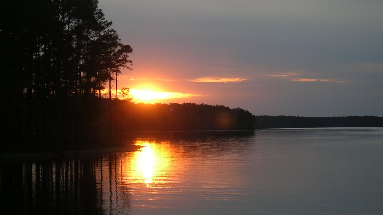
Notes: Lake size, public land, shoreline zoning, permit rules and the Thurmond Project Office number are from the U.S. Army Corps of Engineers, Savannah District (Thurmond pages, Shoreline Management FAQ and allocation maps, May 2018 Shoreline Management Plan release and 2022 Master Plan). Park details and fees are from Columbia County, Georgia State Parks, Fort Gordon MWR and the Corps, checked October 31, 2026. Closures and paving dates are as posted and subject to change. Distances and no-traffic drive times are OpenStreetMap-based estimates; real times vary. Shoreline rules can change, and only the Corps can confirm what’s allowed on a specific lot. This is general information, not legal or survey advice. Hero photo: “Sunset clarkshill-lake” by Linuxerist, Wikimedia Commons, CC BY-SA 3.0, cropped. Information deemed reliable but not guaranteed. Equal Housing Opportunity.